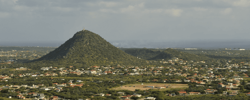
New ecological vegetation map reveals urgent conservation needs for Aruba
Dutch Caribbean Nature Alliance (DCNA)The study offers a comprehensive examination of Aruba’s vegetation, based on over threehunderd sample plots collected between 1996 and 2000. This new map serves as an essential tool for future biodiversity conservation, highlighting significant degradation in the island’s vegetation due to urbanization, tourism, invasive species, and climate change. These findings update the seminal 1956 map created by Stoffers, incorporating modern methods, to provide quantitative data for the first time, which will enable better land-use planning and ecological management moving forward.

Findings
The research revealed alarming findings: significant vegetation loss and degradation due to human activity, particularly urbanization and tourism, with the western side of the island most affected. The findings highlighted a troubling loss of critical vegetation types, including the near disappearance of the ‘evergreen woodland’ and the ‘herbaceous strand community.’ These areas, once vital to Aruba’s biodiversity, have been severely impacted by human activity and invasive species, with significant deterioration in species such as the thorny woodland once derived from evergreen woodland. Moreover, the ongoing issue of roaming livestock, erosion, and saltwater intrusion exacerbated by climate change are further threatening Aruba’s ecological resilience.
Key Recommendations
- Immediate removal of free-roaming livestock in natural areas;
- Propagation and replanting of rare native species;
- Strict control of invasive plant species through an action plan;
- Development of green corridors to connect isolated vegetation patches;
- Protect small surviving landscape elements in urban and industrial areas;
- Implementation of practical infrastructural measures to aid rainwater infiltration into groundwater.
Regional Context
For the wider Dutch Caribbean, this study is a crucial reference point. Aruba’s unique vegetation is a key component of the Caribbean dry forest biome, which extends across neighboring islands like Bonaire and Curaçao. The health of these ecosystems is critical for regional biodiversity, as they support species unique to the ABC islands. Aruba's case highlights the pressing need for the implementation of conservation strategies across the region, such as the removal of non-native livestock, the propagation of endangered species, and the creation of ecological corridors to promote habitat connectivity. This study was commissioned by DCNA and will feed into the soon to be launched Conservation and Restoration of Key Habitats Program. This new program will work to bring together studies such as these to implement impactful conservation and restoration efforts across the six islands. These measures will be essential for building resilience against climate change and ensuring the long-term survival of the region's biodiversity.
More information
You can learn more by visiting this website
Text: Dutch Caribbean Nature Alliance
Photo's: Christian König; Diego Marquez
